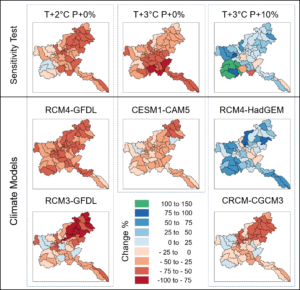
In this project, we used two approaches to project future climate change: an ensemble of global, regional, and dynamically-downscaled climate models; and an ensemble comprised of various temperature and precipitation perturbations on the historical station record. We incorporated climate projections into the Soil and Water Assessment Tool (SWAT) to estimate daily streamflow, and then quantify flooding using indices related to its probability, duration, quantity, and frequency.
Results show an increased temperature can counteract the impact of small increases in precipitation on flood risk, and using climate model data without bias correction can produce similar results to the perturbation of historical climate data. This work moves forward the application of future climate models in SWAT for flood risk evaluation at watershed scales.
